Mapping Gentrification Risk in the Grand Paris
PROJECT a predictive spatial model built in GIS to analyze gentrification risks around Paris associated with the 2024 Olympics and the new transit network under construction.
LOCATION Paris, France
ADVISOR Eric Brelsford | Intro to GIS, The New School
INTRODUCTION
The Paris 2024 Olympics are being touted as an exceptional opportunity to accelerate the construction of the Grand Paris Express subway network, a 38 billion euro transit project that will undeniably transform the geography of the Paris metropolitan area. Public officials claim that these infrastructure projects will channel investments into under-resourced suburban territories, in particular the northeastern suburb known as Seine-Saint-Denis. However, given the increasing unaffordability of housing in Paris, many residents and activists on-the-ground view the Grand Paris and the Olympics as a vehicle to precipitate processes of gentrification and population displacement. I decided to map current demographics and assess gentrification risks to investigate these contradictory claims, and to question the glossy rhetoric surrounding the Grand Paris and the 2024 Olympics.
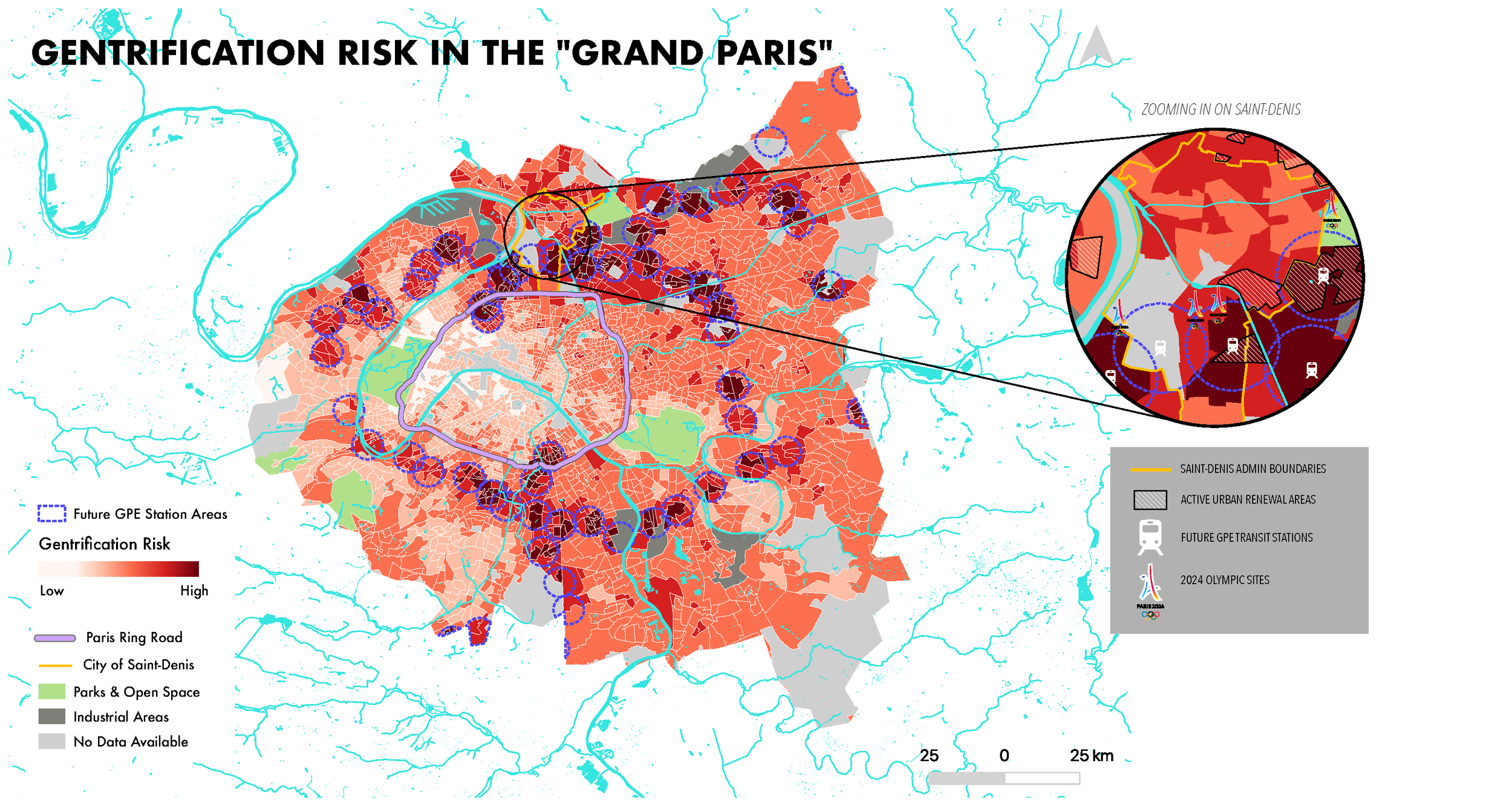
PREDICTING RISK: SPATIAL MODELING
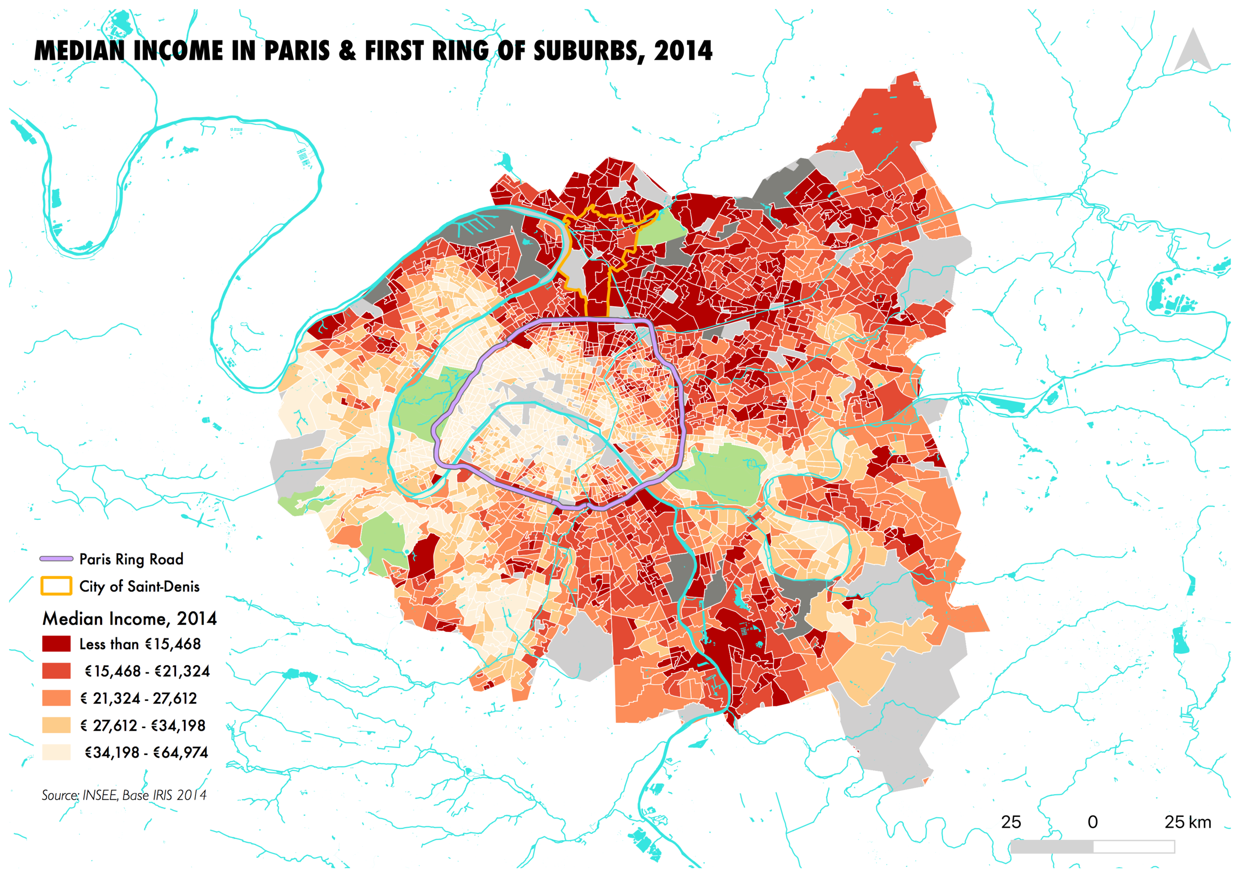
My goal was to build a spatial model that could predict gentrification around Paris, with the hope that it might be useful for residents and activists organizing against displacement. To develop my model, I looked into the indicators used by different cities that have developed early warning systems for gentrification and displacement. I selected median income and proximity to future transit stations as my two indicators. My model could be rendered more complex by using additional indicators such as changes in property values, but I had difficulty accessing real estate data in France.
The first indicator I used is median income. In my model, low-income census tracts are more at risk of gentrification than high-income census tracts. Neighborhoods that are already affluent (i.e. most of the City of Paris), are not going to be gentrified, while low-income residents run the risk of being displaced as property values increase in their neighborhoods.
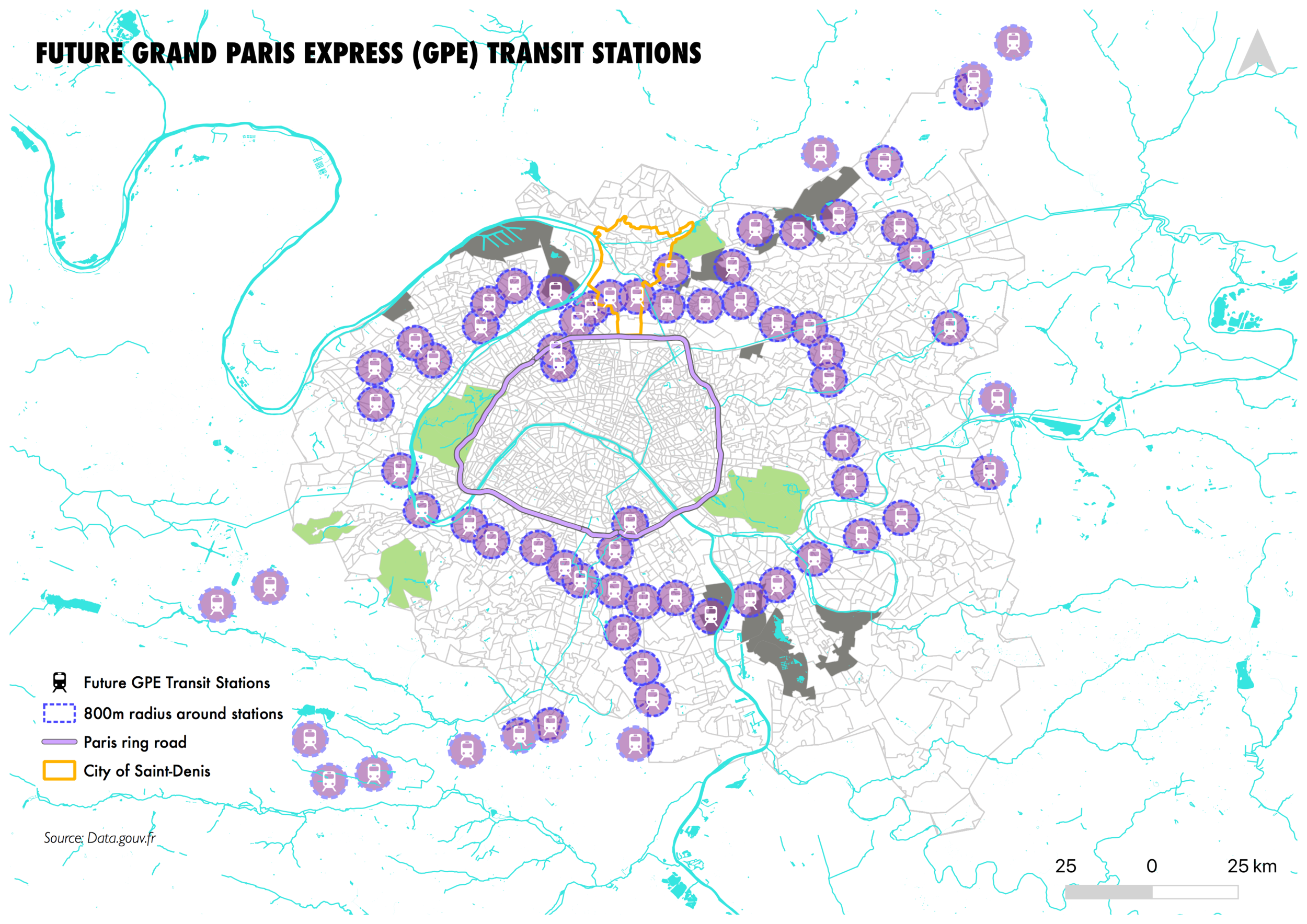
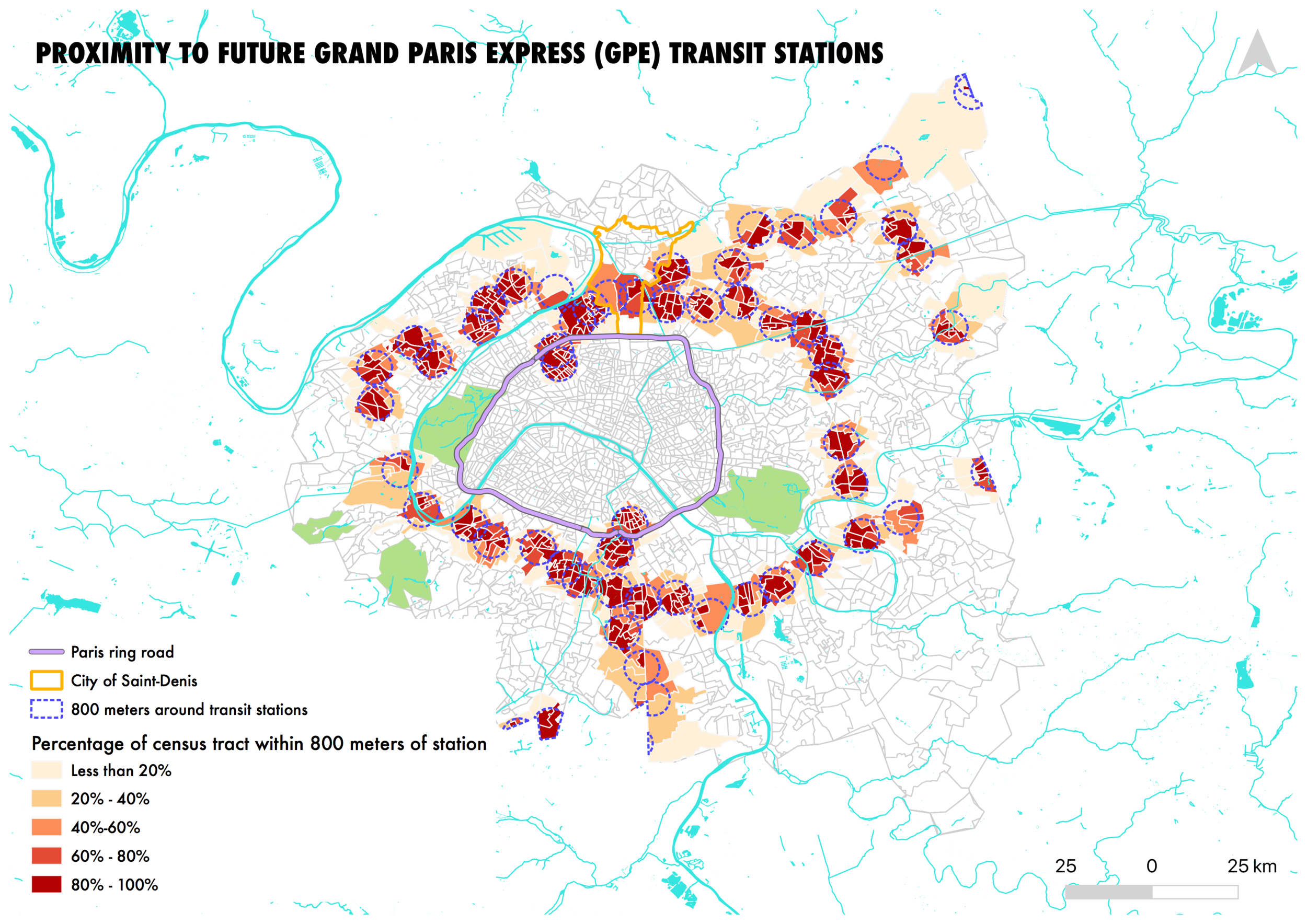
The second indicator I used is the proximity to future Grand Paris Express transit stations, the largest transit development project in Europe, which will add five new subway lines and 62 new transit stations to the Paris metropolitan area. When new transit lines are constructed, property values tend to increase around new transit stations, due to increased attractivity. The Grand Paris Express will connect formerly isolated suburbs to the heart of Paris with a high-speed subway network. Based on my research through media articles and real estate reports, neighborhoods that were previously seen as undesirable are already gaining new attractivity due to the Grand Paris Express train.
I aggregated the two indicators to create a “Gentrification Risk” model. I also highlight a “hotspot” in the City of Saint-Denis, a low-income suburb on the edge of Paris where many Olympic sites are going to be located. Based on my interviews and research, Saint-Denis has been described as the “eye of the storm” of the incoming gentrification wave, due to its proximity to Paris and gentrifying communities of Saint-Ouen and Pantin, new transit stations, and the location of several Olympic sites. The Grand Paris Express train stations in Saint-Denis are set to be completed by the 2024 Olympics to facilitate the circulation of tourists and athletes throughout the metropolitan space.
